Why Puerto Viejo's Driest Months Still Have 15 Rainy Days
What Costa Rica's southern Caribbean coast actually does in September and October, with the national weather service numbers behind it
 Dallas Rogers
The short version: September and October are a real lull in the rain on Costa Rica's southern Caribbean coast, where Puerto Viejo de Talamanca sits. A lull is not a dry season. On the Instituto Meteorológico Nacional's long-term regional baseline, the Caribe Sur averages roughly 190 mm of rain across about 15 rainy days in September and roughly 200 mm across about 16 rainy days in October. That is far less than the Pacific gets in the same weeks, and it is still rain on half the days. Plan a trip that works wet, and you will almost certainly get more sun than you planned for.
Is September and October really the dry season in Puerto Viejo?
No. It is the second of two annual lulls, and it is the shallower one. The Instituto Meteorológico Nacional (IMN), Costa Rica's national weather service, describes the Caribbean as having two rainy periods interrupted by two relative minimums: one in September and October, and a deeper one in February and March. On IMN's own baseline charts for the Caribe Sur, March is the driest month of the year, not September.
This matters because almost every travel page online says the opposite, and travelers arrive expecting Guanacaste in January. Then it rains four afternoons in a row and the trip feels like a mistake it never was.
Here is what the region actually records, rounded from IMN's regional baseline charts for the Caribe Sur (1961 to 1990 reference period).
| Month | Average rainfall | Rainy days |
|---|---|---|
| January | 230 mm | 13 |
| February | 170 mm | 12 |
| March | 150 mm | 12 |
| April | 190 mm | 12 |
| May | 270 mm | 15 |
| June | 250 mm | 17 |
| July | 290 mm | 18 |
| August | 260 mm | 17 |
| September | 190 mm | 15 |
| October | 200 mm | 16 |
| November | 240 mm | 17 |
| December | 320 mm | 17 |
Source: IMN, Clima de Costa Rica y variabilidad climática, Región Caribe (Caribe Sur subregion).
Read the whole column and the picture changes. February, March and April are quietly the driest stretch on this coast. September and October are the good window inside the wet half of the year, which is a different and more useful claim.
One more number worth sitting with. IMN's station records put annual rainfall at 2,740 mm across 182 rainy days at Sixaola, on the Panama border about 35 km south of Puerto Viejo, and 3,163 mm across 181 rainy days at Puerto Vargas, the Cahuita National Park station about 16 km north. The Caribe Sur subregional average is 2,878 mm across 184 rainy days. IMN does not publish a Puerto Viejo town station in this baseline, so those two coastal stations are the honest bracket around it.
About half the days of the year see rain here. That is the actual baseline, and it is also why the jungle behind Playa Chiquita looks the way it does.
Why do September and October get a break at all?
Because the trade winds ease off. IMN's regional analysis is specific about the mechanism: the easterly trade wind blows across this coast nearly all year, and when its intensity drops in September and October, Caribbean rainfall hits the relative minimums of its cycle. Weaker onshore wind means less moisture driven up against the Talamanca range, which means less rain.
That is the same reason the Pacific is soaked in those months and the Caribbean is not. The two coasts are not on opposite schedules by coincidence. They are responding to the same wind from opposite sides of the country.
Which leads to the part no seasonal guide will tell you.
What the trade winds are doing in 2026
They are running stronger than usual, and it has flipped the normal September picture.
IMN's subseasonal forecast valid from 21 September to 18 October 2026, published on imn.ac.cr and read on 17 September 2026, attributes a rainfall deficit across the Pacific, the Central Valley and the western Northern Zone to trade winds more intense than normal, which it calls atypical behaviour for these months. The flip side is on our coast: IMN forecasts wetter than normal conditions for the Caribbean and the Northern Zone through the second half of September.
Here is the four week outlook as IMN published it, with the weekly rainfall ranges for the Caribe Sur.
| Week | Caribbean outlook | Caribe Sur rainfall | IMN's stated uncertainty |
|---|---|---|---|
| 21 to 27 Sep | Wetter than normal | 25 to 50 mm | Low |
| 28 Sep to 4 Oct | Wetter than normal | 25 to 70 mm | Moderate |
| 5 to 11 Oct | Return to normal for the season | 25 to 50 mm | Low |
| 12 to 18 Oct | Drier than normal, countrywide | Not quantified | High |
IMN puts the probability of an extreme event in the opening week at around 25 percent and notes no directly threatening system on the map at time of writing.
So if you are reading this while planning late September in Puerto Viejo, the honest answer is that this year's second half of September is running wetter than the textbook version, and the first half of October currently looks like the better bet. That is a forecast, not a promise, and IMN itself flags the last week as high uncertainty.
How to check this yourself before you book
This is the habit worth stealing from people who live here. Two pages, five minutes, free.
- IMN's subseasonal forecast (imn.ac.cr, Pronóstico subestacional) gives a four week regional outlook with rainfall ranges and, unusually for a forecast product, an explicit uncertainty rating per week. Look for the Caribe Sur line, not the national summary.
- IMN's avisos meteorológicos page carries the short-term warnings: tropical waves, which are the main rain-makers on this coast, and any developing system.
Both are in Spanish. Both are worth a browser translation, because they are the primary source that the English-language weather blogs are loosely paraphrasing weeks later.
If you want a second habit: check the forecast for the Caribe Sur specifically. The Caribe Norte, up toward Tortuguero, is meaningfully wetter. IMN's baseline puts the northern subregion at 3,702 mm a year against the south's 2,878 mm. A forecast for "the Caribbean" is often describing a coastline that starts four hours north of your hotel.
What 15 rainy days actually looks like on this coast
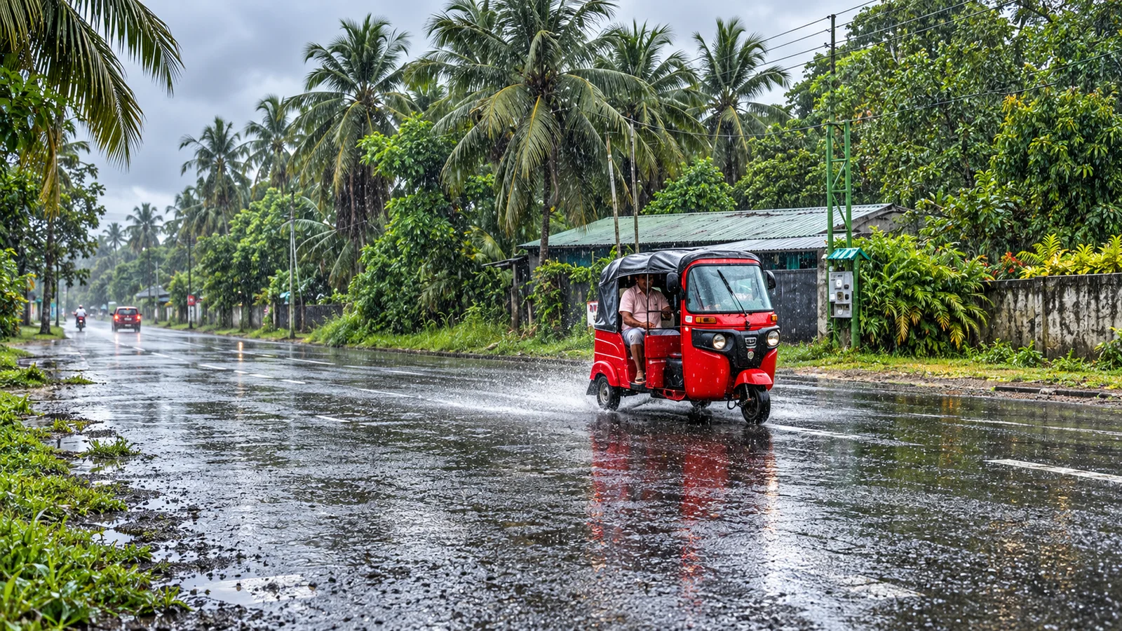
Rainy day does not mean washed out day. It means rain was recorded. On this coast the common shape is a bright morning, cloud building through the early afternoon, an hour or two of serious rain, then a rinsed, cooler evening.
The planning move follows from that shape, not from the forecast.
- Put anything that depends on light and calm water in the morning. Reef snorkelling, the boat out of Manzanillo, the long bike down to Punta Uva.
- Keep the afternoon soft and indoors-adjacent. A chocolate farm under cover, a long lunch, the Jaguar Rescue Center, a nap you will not regret.
- Do not book two days in a row of the one thing you came for. Give it a backup slot.
- Bring the rain jacket you would actually wear, not the poncho that lives in the bag. And bring a dry bag for the bike rides, because the road to Manzanillo has no shelter worth the name.
If you are building a route rather than a single stop, our Puerto Viejo travel guide covers days needed, transport and where to base yourself, and the beach by beach breakdown tells you which stretches stay swimmable when the sea gets pushy. For the park day, we compared Cahuita and Gandoca-Manzanillo so you do not have to do both.
Should you go to the Caribbean instead of the Pacific in September?
In most years, yes, if rain is your main worry. The baseline says the Caribbean's September and October are a lull while the Pacific is at its wettest, and that trade is the single best-known piece of Costa Rica weather strategy.
In 2026, the trade is narrower than usual. IMN currently has the Pacific unusually dry and the Caribbean unusually wet through late September, then both easing in October. If your dates are in the next two weeks and your priority is dry beach time above all else, that is genuinely worth a conversation before you commit.
But rain is rarely the only variable. The Caribbean coast in September is quiet in a way the Pacific never is in February. Puerto Viejo, Cahuita and Manzanillo in the green season have space on the beaches, tables at the sodas, and a version of the town that belongs to the people who live in it. Dallas lived on this coast for close to a year in his twenties, which is why we send people here at all, and why we send them in the months most itineraries skip. If you want the wider case for travelling Costa Rica between May and November, we made it in our green season guide.
One practical note on the drive: Route 32 through Braulio Carrillo is the road in from San Jose, and it is the piece of this trip most affected by heavy rain. Our San Jose to Puerto Viejo guide walks through the options. Whatever you choose, aim to arrive in daylight.
The honest summary
Puerto Viejo in September and October gives you the best rain odds of the wet half of the year on Costa Rica's southern Caribbean coast, roughly 15 to 16 rainy days a month against a July that runs 18. It is not a dry season. February and March are drier on this coast. And in 2026 the usual pattern is running against type, with IMN forecasting a wetter than normal late September on the Caribbean and a drier first half of October.
Which is a long way of saying that the question is not "is it the dry season." The question is "what are my actual dates doing, and what should I book around them."
Tell us your dates and we will tell you what the Caribbean is realistically doing that week, and how we would shape the days around it. Message Dallas and Marta on WhatsApp. No commitment, and no planning fee.
Pura Vida.
Sources: Instituto Meteorológico Nacional, "Clima de Costa Rica y variabilidad climática," Región Caribe regional analysis (1961 to 1990 baseline); IMN, "Pronóstico subestacional," valid 21 September to 18 October 2026, retrieved 17 September 2026. Written by the Toorizta team with Dallas and Marta, who plan Caribbean coast trips from Costa Rica.
Toorizta is how modern travelers plan, book and share Costa Rica trips. Open the app to build your own.
Open the Toorizta app