El Salvador Travel Guide: Volcanoes, Surf and the Safety Question
The smallest country in Central America is also the easiest one to see properly in two weeks. Here is what is actually worth your time, what the trip really asks of you, and how to think about safety honestly.
 Dallas Rogers
The short version: El Salvador is the smallest country in Central America, and that is its advantage. You can sleep in one place and still reach a cloud-wrapped volcano crater, a crater lake, a Maya village buried in ash, a coffee town and a black sand surf break. Ten days to two weeks is enough to see the country without rushing. The safety picture has genuinely changed, though the honest answer is more layered than a single word, and we get into that below.
Why this country rewards a short trip
Most Central America itineraries ask you to spend your holiday in transit. El Salvador does not. The drive from the Pacific coast to the western highlands is a morning, not a day. Nothing about that is marketing: it is simply geography, and it changes what a two week trip can hold.
What it means in practice is that you can keep two or three bases instead of five, unpack properly, and still wake up somewhere different in character every few days. The cloud forest air at 2,000 metres and the warm salt air of a surf village are closer together here than they have any right to be.
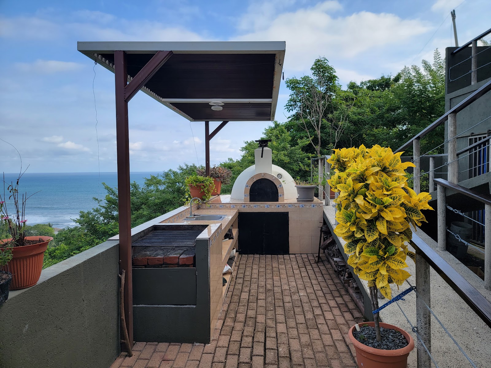 El Salvador
Is El Salvador safe? What the official sources actually say
This is the first question almost everyone asks, so it deserves a straight answer rather than reassurance.
The United States Department of State currently places El Salvador at Level 1, Exercise Normal Precautions, its lowest advisory tier, in an advisory updated 25 June 2026 (travel.state.gov). Level 1 is the same category applied to much of Western Europe, and for a country that carried a Level 3 "reconsider travel" rating a few years ago, that is a real shift rather than a cosmetic one.
It is not the only official view. Canada's government advice asks travellers to exercise a high degree of caution, citing crime and the risk of arbitrary enforcement of local laws (travel.gc.ca). That second point is about the legal environment under the country's extended state of emergency, not about tourist muggings, and it is worth reading before you go rather than discovering later.
Both things are true at once. Street crime that once shaped daily life in San Salvador has fallen dramatically, and independent travel through the places in this guide is now ordinary. At the same time, this is a country in the middle of a political experiment, and a visitor should behave like a guest in someone else's legal system: carry your documents, stay out of protests, be careful what you photograph around police and military, and follow local guidance about which neighbourhoods to skip after dark. Those are the same habits that serve you in most of the region.
One practical risk gets less attention than crime and deserves more: the Pacific surf. These beaches have strong rip currents, and the US Embassy in San Salvador has issued specific alerts about rip current risk at tourist beaches. If you are not a confident ocean swimmer, swim where there is a lifeguard and ask locally before going in.
The places worth your time
| Place | What it is for | Give it |
|---|---|---|
| San Salvador | Arrival, city food, markets, museums | 1 to 2 days |
| Santa Ana and Cerro Verde | Volcano hiking, crater lake | 2 to 3 days |
| Ruta de las Flores | Coffee towns, food, slow mornings | 2 days |
| Joya de Cerén and Tazumal | Maya archaeology | half day each |
| Suchitoto | Colonial lake town, quiet | 1 to 2 days |
| El Tunco and El Zonte | Surf, sunsets, coastal nightlife | 2 to 4 days |
| Bahía de Jiquilisco | Mangroves, birds, turtles | 1 to 2 days |
San Salvador, not just an airport
The capital is young, loud and more modern than most people expect. It works best as a one or two day opening act: the historic centre on foot, a market lunch, a museum, and an early night before you head west. Treat it as the place where you learn to read the country rather than a box to tick.

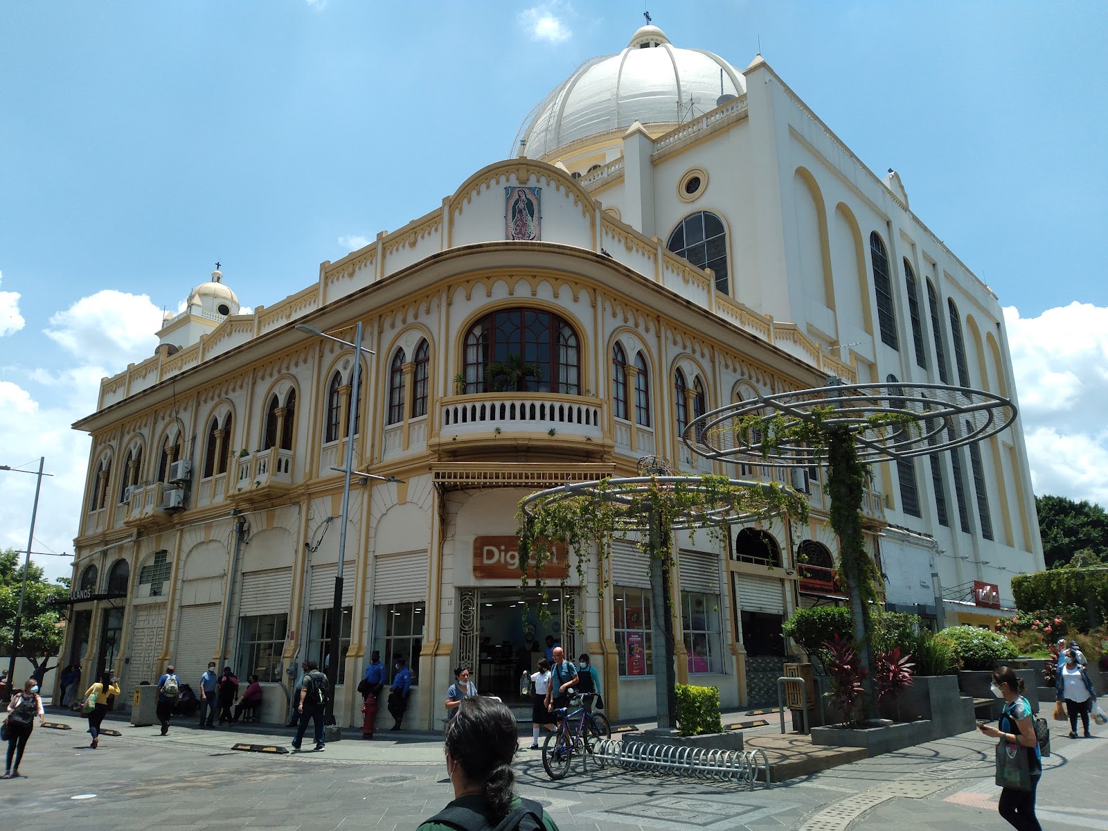 San SalvadorEl Salvador
Santa Ana Volcano and Lake Coatepeque
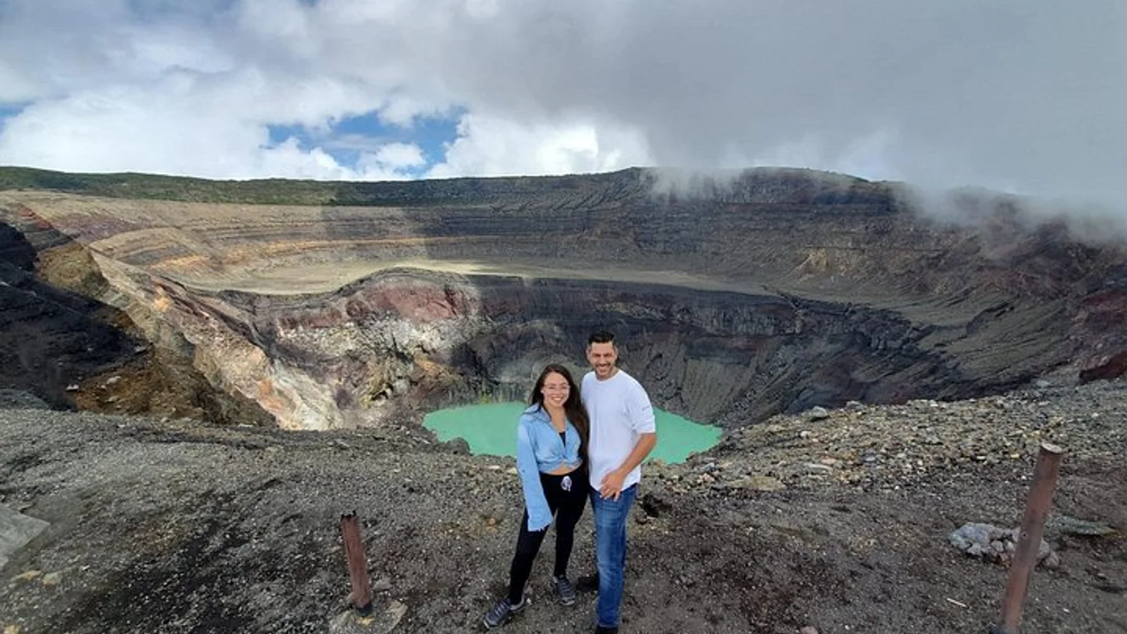
This is the single image most people carry home. Santa Ana Volcano, known locally as Ilamatepec, is the highest volcano in the country at 2,381 metres, and the hike ends at a rim looking down into a pale green sulphur lake, with Izalco's black cone and the blue bowl of Lake Coatepeque spread out below.
The practicalities matter here. The hike starts inside Cerro Verde National Park, you go with an authorised guide rather than alone, and departures run on a schedule the park sets, so this is a morning commitment rather than a spontaneous afternoon. The national tourism board lists park entrance at three dollars for foreign visitors (elsalvador.travel, checked October 2026). Confirm the current departure window and fees before you drive out, because both have changed over the years, and cloud can close the view by midday.
Santa Ana Volcano (Ilamatepec)Santa Ana, El SalvadorThe highest volcano in El Salvador at 2,381 metres, rising above Cerro Verde National Park in the Apaneca-Ilamatepec range. The hike to the rim looks down into a pale green sulphur crater lake, with the cone of Izalco and the blue bowl of Lake Coatepeque below. Access is from inside Cerro Verde National Park with an authorised guide, on departures scheduled by the park, so it is a morning commitment. Clear mornings give the best chance of a view before cloud builds.Lake Coatepeque itself, a flooded volcanic crater a short drive below, is where you recover afterwards. Lunch by the water, a swim, nothing more ambitious than that.
 Best Day Tour: Santa Ana Volcano Hiking + Lake CoatepequeSan Salvador, El Salvador
Ruta de las Flores
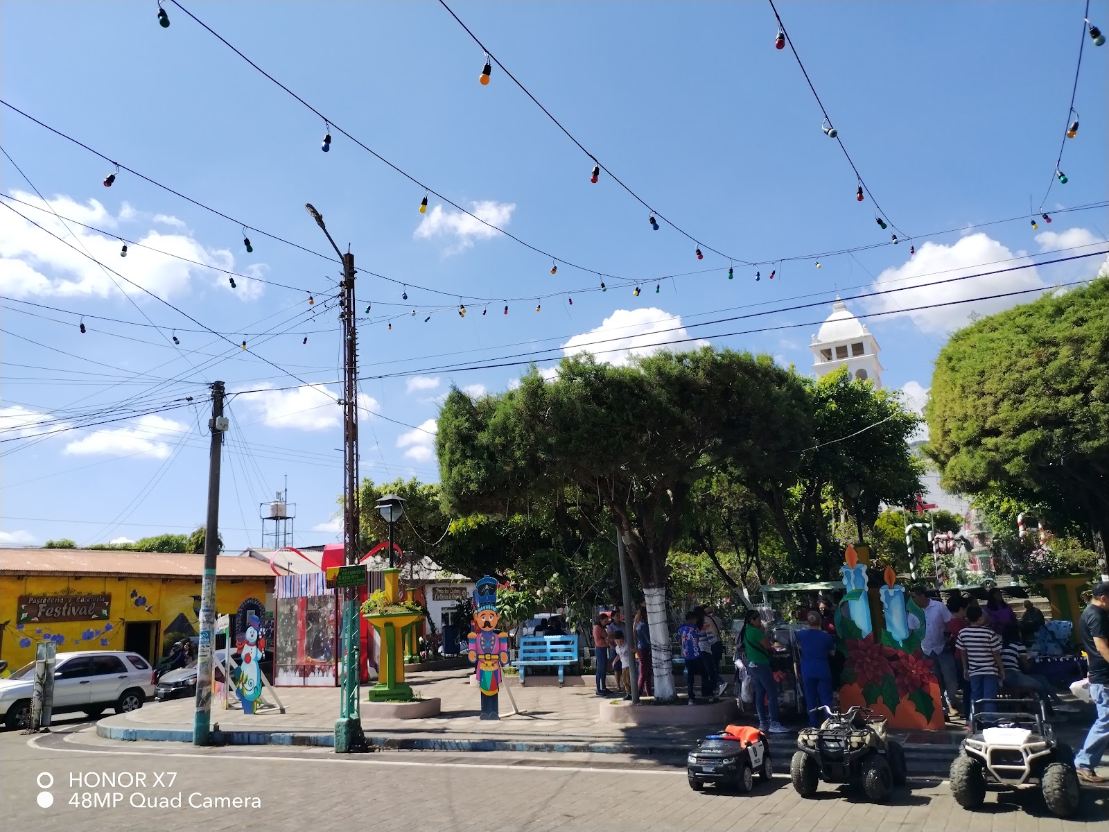
The Route of the Flowers is a highland road linking a string of small towns through coffee country. It is the most purely pleasant part of the trip: cooler air, painted walls, weekend food fairs, coffee farms that will show you the whole process from cherry to cup. Go slowly. The point is not to drive the route but to stop four times along it.

 Ruta de las FloresEl Salvador
The Maya sites, and why Joya de Cerén is special
Tazumal, at Chalchuapa near Santa Ana, is the country's most substantial standing pre-Columbian complex. But the site that justifies a detour is Joya de Cerén, El Salvador's only UNESCO World Heritage site, inscribed in 1993. It is not a temple city. It is a farming village buried by a volcanic eruption around the seventh century, which preserved the ordinary: houses, kitchens, storerooms, planted fields. UNESCO's listing calls out exactly this, that the site shows the daily life of a Maya farming community rather than the monuments of its rulers (whc.unesco.org).
Dawn and dusk apart, it is a modest looking place. Go with a guide or read first, because the meaning here is in the detail rather than the skyline.
Suchitoto
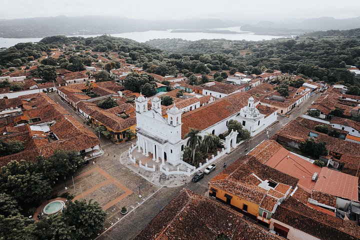
A cobbled colonial town above a reservoir, built for slow days: boats out to the islands, birds, a church, a plaza where nothing is urgent. If your trip has been volcano hikes and surf, this is the exhale.
 Cihuatán Rum Distillery, Archaeological Site & Suchitoto TownSan Salvador, El Salvador
The coast: El Tunco, El Zonte and the mangroves
The Pacific coast of La Libertad is where most visitors end up staying longest. El Tunco is the social centre, dark volcanic sand, right point breaks, bars that stay open; El Zonte, a few minutes away, is quieter and better if you want the surf without the volume. Both work for beginners in the right conditions, with lessons easy to arrange.
Further east, Bahía de Jiquilisco is a different coast entirely: a vast mangrove estuary and biosphere reserve, important for nesting sea turtles and for birds. It is the part of the country most visitors skip and the part that rewards an extra day most, provided you accept that getting there is slower.

El TuncoEl Salvador
When to go
The dry season runs roughly November to April, with reliable sun, clearer volcano views and the busiest weeks around Christmas, New Year and Semana Santa. Book ahead for those, especially on the coast.
From May into October the rains arrive, usually as heavy afternoon storms rather than all day drizzle. The country turns green, the coffee highlands look their best, prices soften and the surf on the Pacific is generally at its most consistent. Mornings are often clear enough to hike. If you can tolerate planning around weather instead of ignoring it, this is the better value half of the year.
Where to base yourself
Three bases cover almost everything:
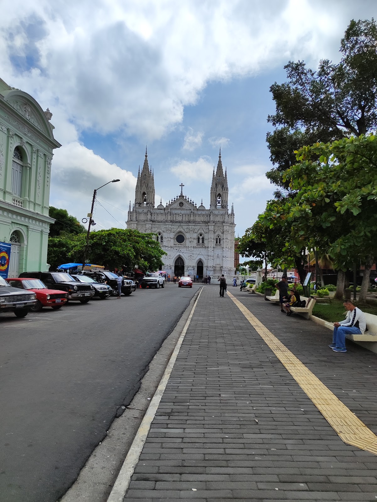
- Santa Ana or near Lake Coatepeque for the volcanoes, the crater lake and the archaeology.
- A Ruta de las Flores town for coffee country, cool nights and food.
- El Tunco or El Zonte for the ocean, and because it is an easy last stop before flying home.
Add Suchitoto if you want quiet, and a night in San Salvador at the start if your flight lands late.
 Santa AnaEl Salvador
Getting around
Three realistic options, and they suit different people.
Rental car. The most freedom, and the reason most independent travellers enjoy this country. Main highways are decent, distances are short, and having a car makes the Ruta de las Flores and the Maya sites far easier. Drive in daylight, use a navigation app, and expect urban traffic and occasional unlit rural roads.
Buses. Cheap, frequent and genuinely used by everyone, including chicken buses between towns. Slower, and routes that look simple on a map can need two or three changes. Fine if you have time and some Spanish.
Private shuttles and drivers. The middle path. You keep the door to door convenience without driving, which is what most families and first-time visitors actually want, and it removes the two parts of the trip people find stressful: airport transfers and the mountain roads.
Money, paperwork and what it costs
El Salvador uses the US dollar, which removes one layer of friction. Carry small bills: markets, buses, park entrances and rural restaurants often cannot break large notes, and card acceptance thins out quickly outside cities and tourist towns.
On entry requirements, be careful with anything you read secondhand, including this page. Many nationalities enter for short tourist stays without a visa, and some require a tourist card issued on arrival. The rules and the fee attached to that card have both changed recently, and sources that look authoritative currently contradict each other on whether a charge still applies. Check your own nationality against El Salvador's official immigration guidance, or your nearest consulate, close to your departure date.
On budget, El Salvador remains one of the better value countries in the region for food, local transport and small guesthouses, while coastal boutique hotels and private guiding sit at international prices. We would rather point you at the shape of the costs than publish a daily figure we cannot stand behind.
What to eat
Pupusas, first and repeatedly: thick griddled corn or rice masa pockets filled with beans, cheese, loroco flower or chicharrón, served with curtido and a thin tomato salsa, eaten with your hands at a roadside pupusería for small money. They are the national dish and the best cheap meal in Central America.
Beyond that, look for yuca frita with pickled cabbage, seafood soups and whole fried fish on the coast, tamales, and the coffee, which deserves attention in the highlands where it grows. Market comedores are where to eat well for very little. Choose busy stalls with high turnover, the usual rule everywhere.
A route that makes sense
One week: San Salvador, then Santa Ana for the volcano and Coatepeque, then two nights on the Ruta de las Flores, finishing with three nights at El Tunco or El Zonte.
Ten days to two weeks: the same spine, with Joya de Cerén and Tazumal added on a travel day, two nights in Suchitoto, and either a longer coastal stay or the push east to Bahía de Jiquilisco. Two weeks is the length at which this country stops feeling like a tour and starts feeling like a visit.
Planning yours
El Salvador is straightforward to travel and genuinely easy to get wrong in small ways: hiking on the one morning the crater is socked in with cloud, basing yourself an hour from the beach you actually wanted, booking a coastal week in the fortnight everyone in the country is also at the beach.
If you are weighing up this trip, send us the dates you are considering and what you want out of it, whether that is surf, volcanoes, coffee towns or something quiet with good food. Ask us anything you are unsure about, including the safety question. We would rather answer it properly than have you guess from a comment section.
Pura Vida 🌿
Toorizta is how modern travelers plan, book and share Costa Rica trips. Open the app to build your own.
Open the Toorizta app